eCard #116 – Toodling Around Uganda
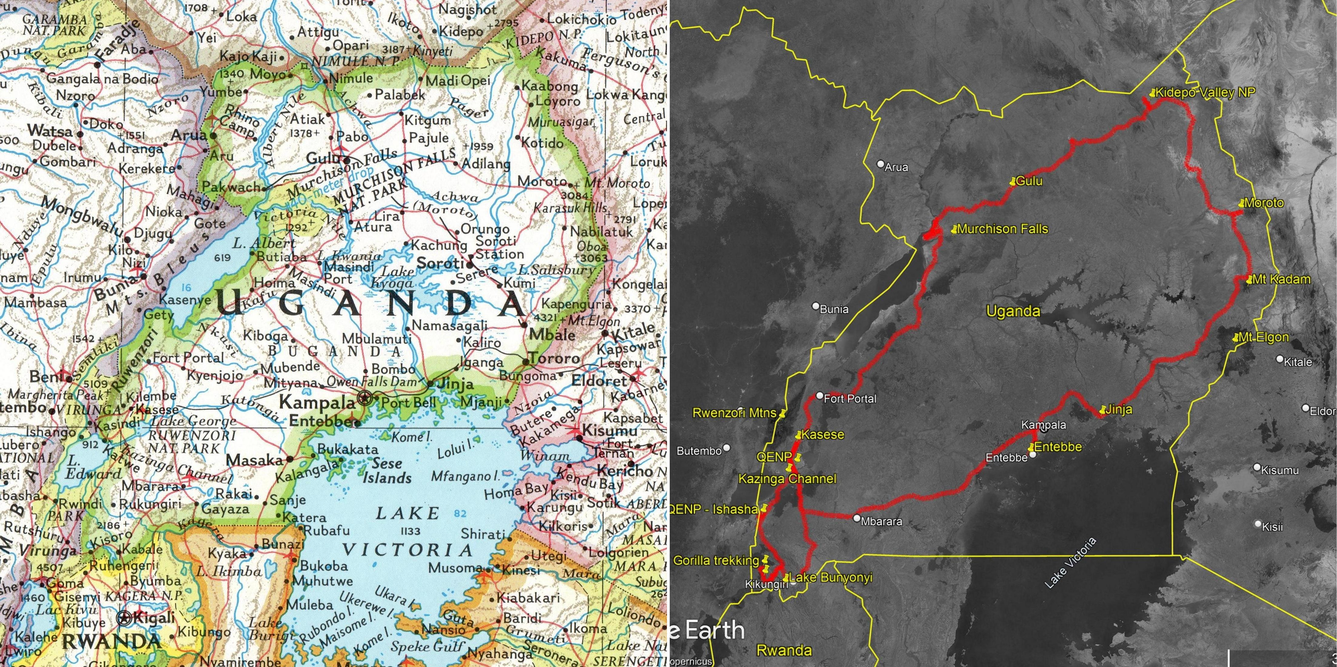
I had organized a car and driver/guide to take me around to some of the national parks in Uganda after hiking in the Rwenzori Mountains (eCard #115). I used local (Kampala) agent Churchill’s Tailored Safaris – great front-end experience via email and WhatsApp with Ether (EHT-air) putting together an itinerary.
Having bailed out of the mountains trip unexpectedly early, Ether was able to extend my itinerary at the front end very quickly. (It was the low season for tourists.) What was originally a look at the national parks in the southwest of the country became a grand tour. Brighton, picked me up the in the expedition Landcruiser the day after I returned to Kasese from the mountains, and off we went.
The pics on flickr are in two albums:
Queen Elizabeth National Park, Part I
I’ve never hired a guide just for me alone for any period of time, so I thought it was going to be a bit weird. The potential weirdness was compounded when checking into the Buffalo Safari Resort in Queen Elizabeth National Park it became apparent that I was the only guest there . It’s a really nice place, and was staffed for a full house. I had the impression that everyone were recent graduates of hospitality training and anxious to put their skills into practice. Four people checked me in, three showed me my room, etc.

This lodge (as for most places I stayed) was within the national park boundaries. There were mongoose and monkeys outside my room. Elephant poo on the walkway. I was instructed to call for an escort to/from my room between 7PM and 7AM. He carried a big flashlight, swinging it around checking the brush on either side of the walk, and he carried a big billy club. I’m not sure what use a billy club is against a charging elephant, but I felt safe. At least he didn’t carry an AK47.
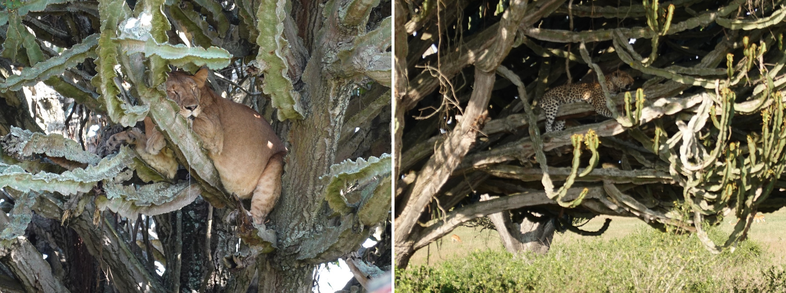
After lunch we headed off for the first game drive of the trip. I told Brighton that I had been to Africa in 2000 for six months and saw many animals, but never saw a leopard (one of the BIG FIVE – lions, leopards, elephants, rhinos, and buffalo). As all guides do, he made no promises, but said we would have several chances to see them on our trip. We hit the road about 3:30PM. At 4:10 we saw the first lion of the trip relaxing from the heat in the branches of a tree. At 4:45 we saw a leopard in a candelabra tree. And at 4:50 saw a second leopard in another tree… Um. Wow! There were loads of elephants, a few hippos and countless antelope-like critters. Not a bad first afternoon.

The overly attentive service didn’t end with check-in. I was told that meals were a fixed menu since the kitchen would be cooking just for me. No problem, I’m easy. Then the waitress listed several choices of appetizer and five choices for the main course for dinner. The meals were superb.
Some of the best food I’ve ever had. Anywhere.
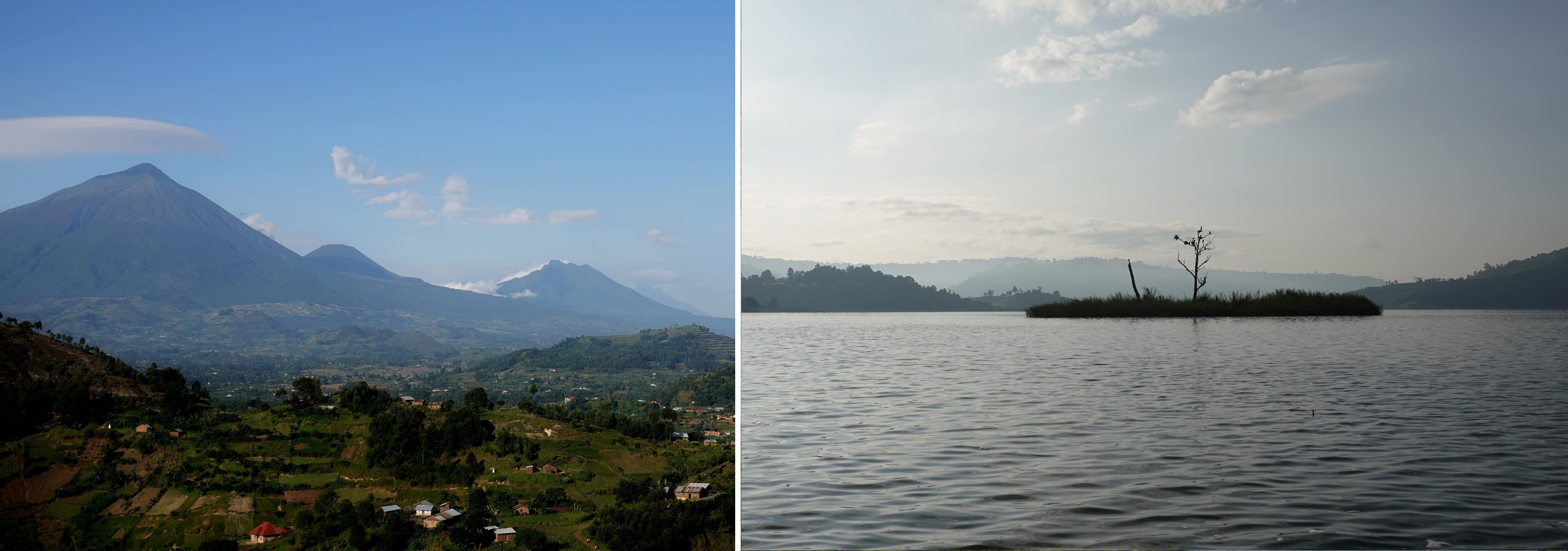
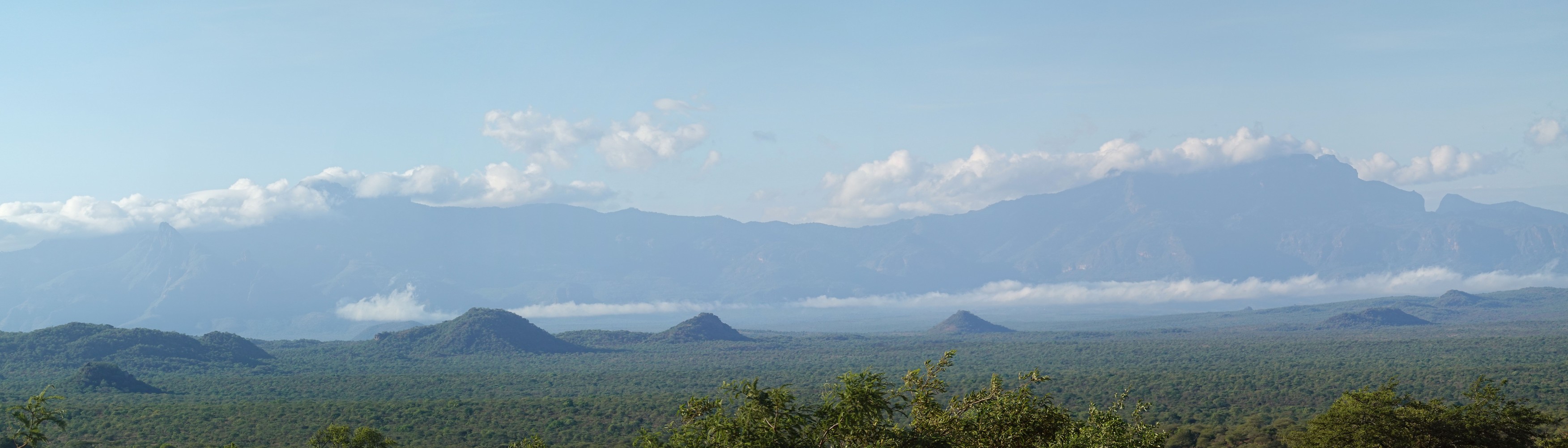
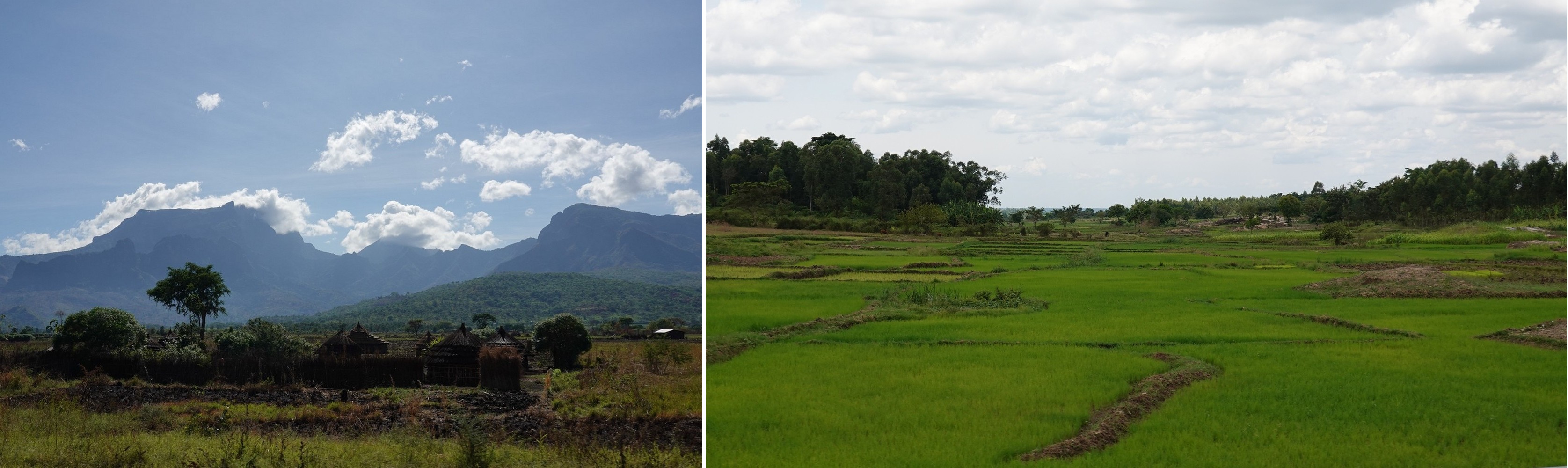
And it wasn’t just due the elephant poo ambience. We were only here for two nights, but I could have luxuriated between the dining room and the pool looking across the valley to the Rwenzori Mountains for quite some time.

Geologic Digression
The valley I looked across to the Rwenzoris is a rift valley. Normally we hear about tectonic plates crashing into each other, either pushing ground up to form mountains (like where the Indian plate crashes northward into the Eurasian plate forming the Himalayas), or where plates slide along or under one another – fault lines and subduction zones like the west coast of the Americas forming chains of uplifted mountains and volcanoes. And all this gnashing of plates generates earthquakes.
Rifts occur where the tectonic plates are pulling apart. As they pull apart they make the crust thinner leaving lowlands between them, and this also allows volcanoes to appear (Kilimanjaro and Mt. Kenya are on the Eastern African rift). Iceland is still forming this way – it’s at the northern end of Mid-Atlantic Ridge – the separation line of the continuing expansion between the North and South American plates as they pull apart from the Eurasian and African plates.
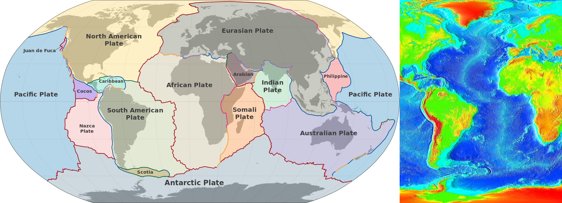

As a rift valley expands, water intrudes to form lakes and further expansion results in outlets to the sea, or a sea forms. The Atlantic Ocean is the end result of this process. In east Africa this process is in a younger phase (only 20 million years old). The East African Rift extends for almost 6000km and has formed a chain of lakes – The Great Lakes of Africa.

The other Great Lakes are in North America. There are interesting comparisons. The most striking for me is that the lakes in Africa contain 25% of the unfrozen fresh water in the world. The N. American lakes contain 21% (though I don’t think that number includes the Great Bear and Great Slave lakes in Canada).
- Homework: What are the biggest fresh water lakes in the world in terms of surface area? Volume? Depth?
- Hint 1: One lake holds all three records.
- Hint 2: It’s not in Africa.
- Hint 3: It’s not in New Hampshire.
- Hint 4: In area it’s about 50% larger than New Hampshire.
(Reader Jim L. told me I was a frustrated teacher. That may well be. But my only frustration is with the quality of my students 🙂 )
Queen Elizabeth National Park, Part II
QENP is on the floor of the western part of the East African Rift Valley – The Albertine Rift Valley (I guess named for it’s proximity to Lake Albert). It’s elevation is low, and it’s on the equator. It’s hot. If not for the vegetation beyond the poolside umbrellas, you could see the 20 mile long Kazinga Channel from the pool at the lodge. This is a natural waterway connecting Lake George and Lake Edward. (Lake Albert is farther north near Murchison Falls.)
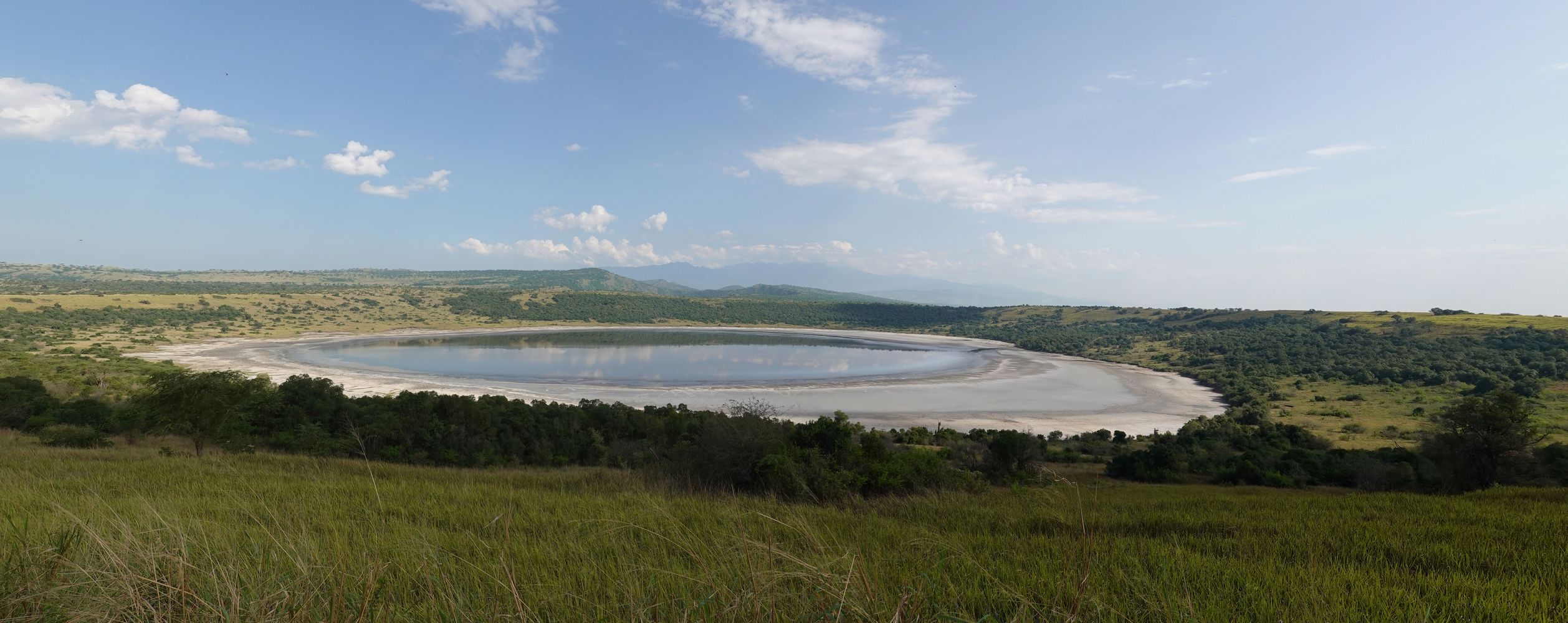
The next morning we did a drive paralleling the channel that took us through an area of low volcanic craters. Some of them contain saline lakes, and there is a minor salt industry collecting it. We passed a large herd of elephant in the distance hanging around near the water. (Suggested collective nouns for elephants include herd, parade, memory, trunkful, tusker. For hippos you can use bloat, herd, pod or crash, though I prefer to use “crash” for rhinos. For Tibetan momos I suggest “belch”.)
We turned around in the small town of Katwe after watching a bloat of hippos in the water. One female hippo was floating in the water dead, and several young hippos kept approaching her body and nudging it.

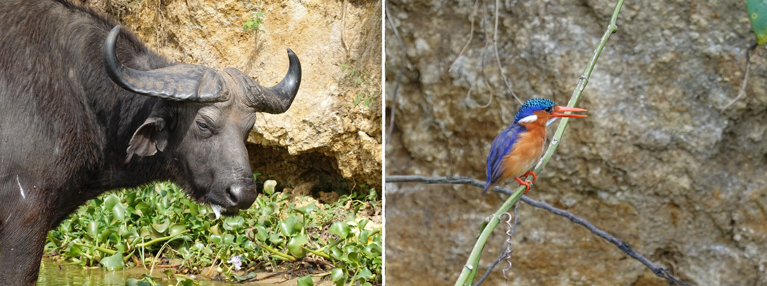
That afternoon I took a boat trip up and down a small section of the channel and saw elephants, hippos, and buffalo from the water. An iguana was prowling the shore for crocodile eggs. We didn’t see any Nile crocs.
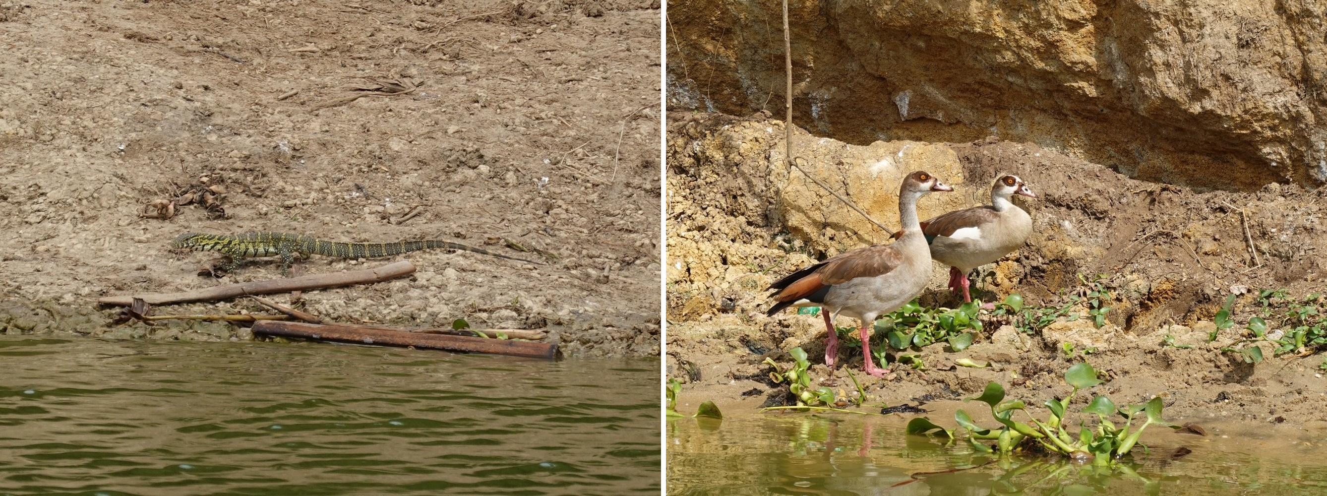
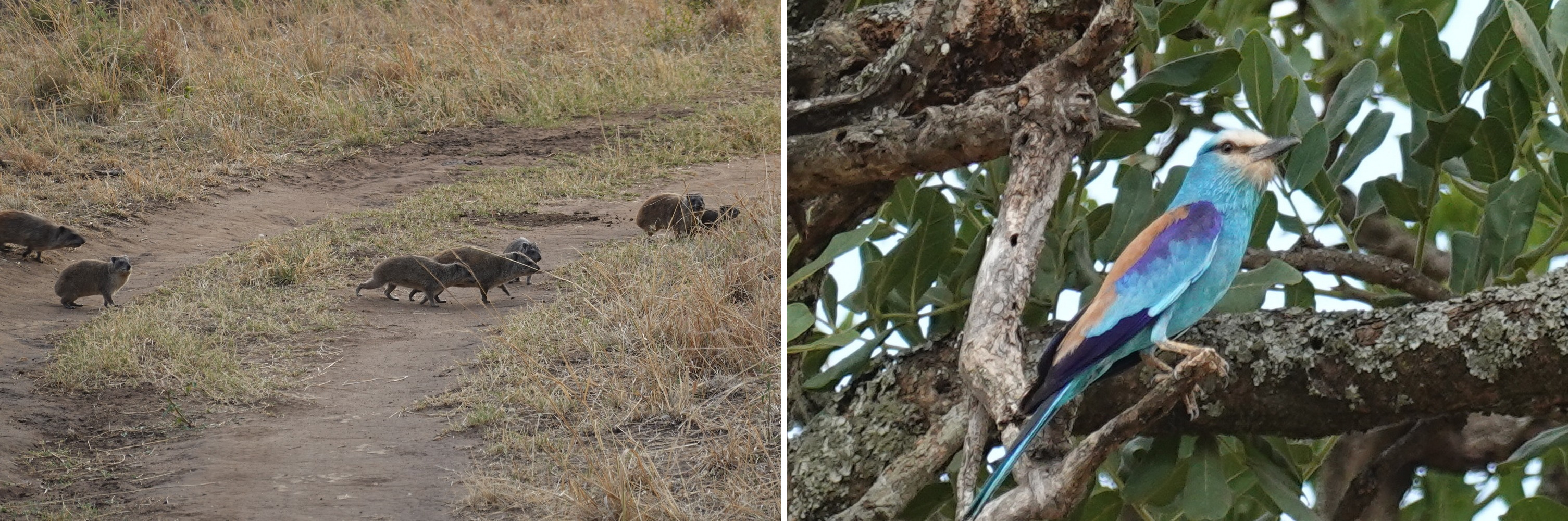
There were a few colorful birds. My dad was an avid birder, and I know my folks came to Africa at least once to extend his list, but they didn’t make it to Uganda. There are 1000 native species in the country, plus about 200 varieties that migrate here from the European winter.
Queen Elizabeth National Park, Part III
Moving south to the Ishasha section of the park we did afternoon and morning game drives. The park is noted for seeing lions lounging in branches of the big fig trees. We went to all the fig trees Brighton knew of and didn’t see any lions. Didn’t really matter. It’s a pretty place. We saw some topi and a distant view of the big volcano, Mt. Muhabura, on the Rwandan border.

From Ishasha we had a long drive south and a climb in altitude away from the floor of the rift valley to the cool environs of Lake Mulehe which would be the base for a mountain gorilla trek.
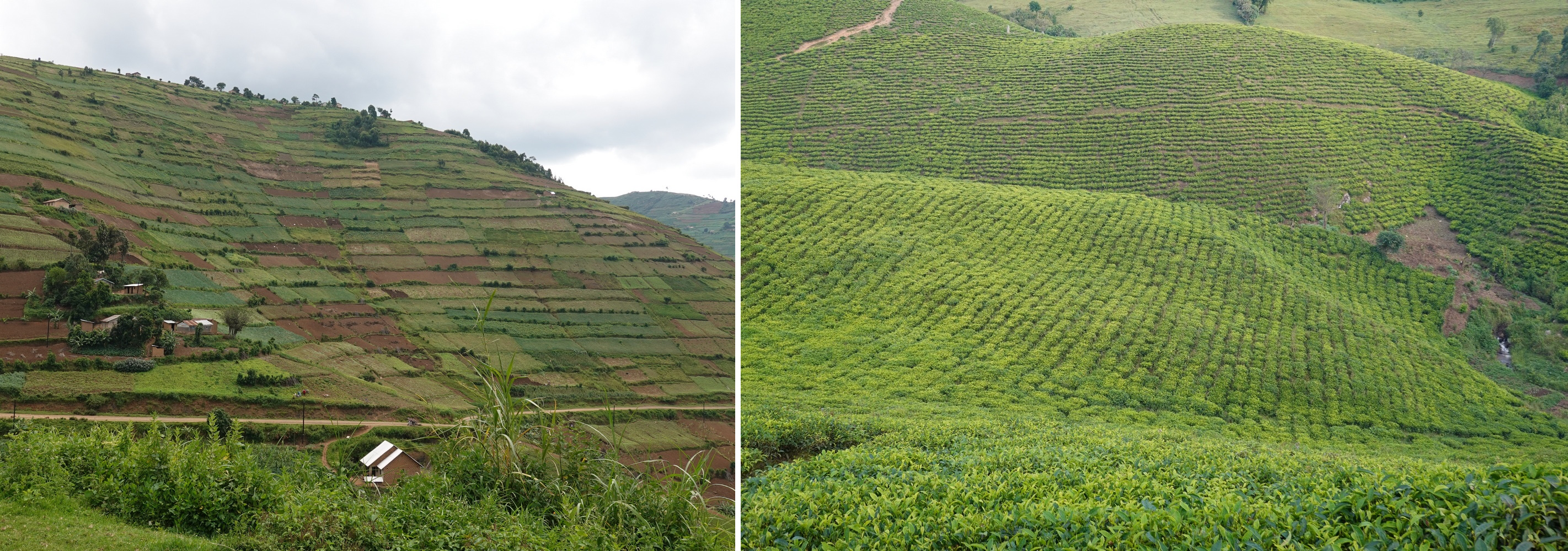
One of the striking things about Uganda is how green it is. It’s incredibly lush, though a bit drier on the floor of the rift valley. But in the hills we’re talking Garden of Eden lush. Brighton declared, “Uganda is a poor country, but no one starves because there’s food everywhere!” This was certainly true in the southwest (definitely not true in the northeast…). Bananas are the staple food crop, and coffee and tea the major cash crops. You also see a lot of cassava/manioc growing.
Lake Mulehe Gorilla Lodge was perched on the south facing slopes above the lake with a great view of Mts. Muhabura and Mgahinga. This was the third lodge I stayed in, but the first place that had other guests.

Bwindi Impenetrable Forest
Returning to Uganda I absolutely had to see the mountain gorillas again. My previous visit in 2000 (eCard #9) ranked as the number one or two best hour-long experiences ever. It’s always a risk to go back to a place to try to re-live an experience. It’s usually different and not as great. And I suppose in the intervening 24 years I’ve become a bit jaded in my travels, and not apt to gush enthusiastic without good reason. But I do have to say being in the wild with large wild animals that can easily kill you is a thrill. Even if they are habituated to humans. So this trip, though different in details, was no different in the experience.
This year I saw the gorillas in Bwindi Impenetrable Forest, and we saw a small family with one silver back, a couple of females and a few juveniles. In 2000 I saw them in Mgahinga Gorilla National Park just a bit farther south right on the border with Rwanda – a group comprised of two big silver backs, females, juveniles and a 3 month old baby. It’s difficult to see them in the dense foliage, but that makes it more fun.

The old eCard noted that we got to within about 15 feet of the animals. Although the sign at the briefing hut says you have to stay 10m away, this time we were within just a few feet of them. At one point the tracking guide had lost track of the big silver back in the dense foliage, and he came rushing past me just a few feet away. Wowzers!
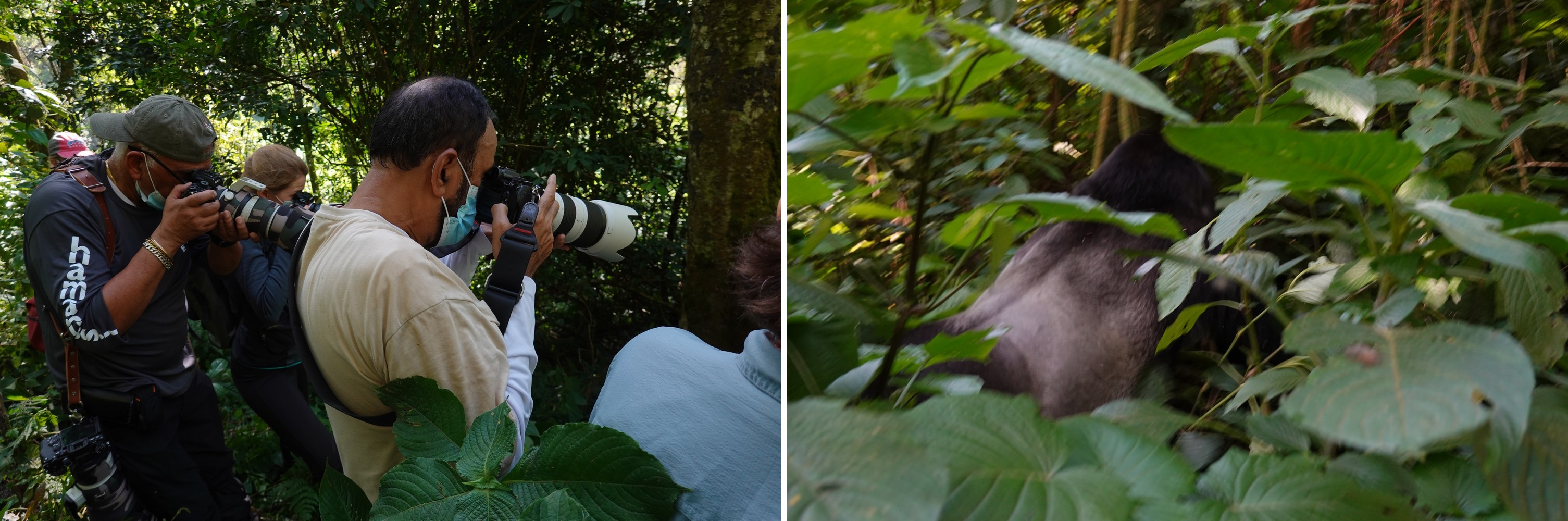
I mentioned in eCard #9 that I shot “several” rolls of film in the hour we had with the gorillas. So that’d be 108 photos (actually a few less). In the hour with the gorillas this year, now armed with a digital camera, I took a hasty 700 pictures and a couple of videos. I took no selfies.

I’ve posted photos from both visits on flickr
On to Murchison Falls National Park
From Lake Mulehe we had a long drive to Murchison Falls which is north of the Rwenzoris. We drove up and down the hilly terrain of the region with one final look back to the volcanoes marching south. The drive was broken up over a couple of days with one night spent on Lake Bunyonyi.
The standout sight on the lake commemorates a milestone in the subjugation of women. Punishment Island is where unmarried girls who became pregnant were abandoned to starve or to drown trying to escape. Single men unable to afford the bride price for an “untainted” woman could rescue them.
Pressing on, we were back to the heat of the rift valley, and we didn’t leave the heat for the rest of the trip.

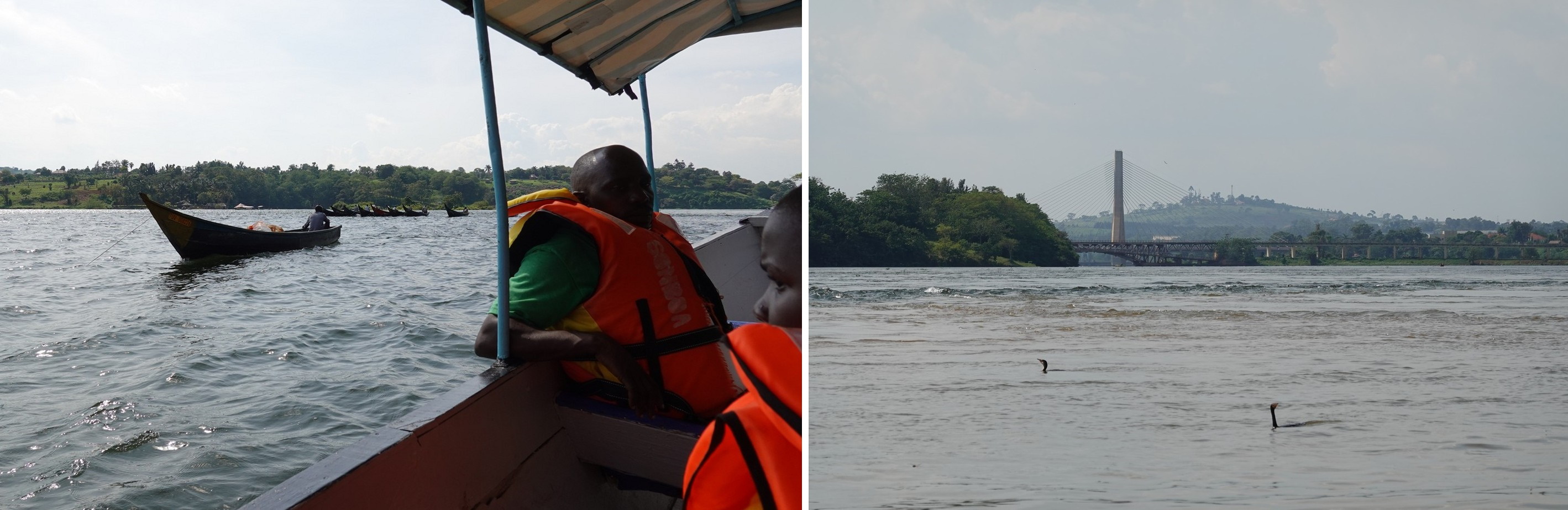
All the water in the Nile River as it flows north out of Lake Victoria squeezes through a 20 foot wide cleft in a rock escarpment as it drops 150 feet, creating Murchison Falls. I took a boat trip up the Nile to view the falls. Unfortunately, we didn’t get as close as I would have liked, but there was quite a bit of wildlife to see enroute. After the boat trip, Brighton drove us to the top of the falls for the view from above.


The national park is a huge place, and on the game drives we saw many giraffes, elephants, hartebeest, patas monkeys, and baboons. Off in the distance we saw three lions hanging around in the shade, but no leopards.


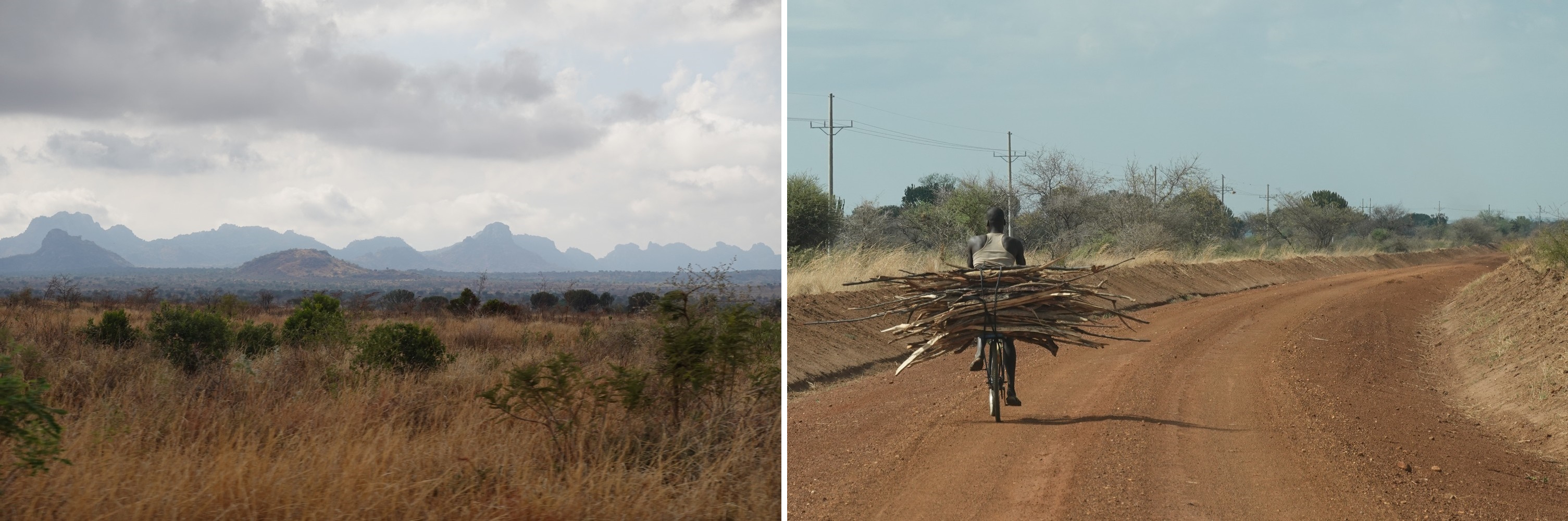
A Long Jaunt to Karamoja and the Kadepo Valley
Departing Murchison, it was a two day drive to the remote Kadepo Valley National Park in Karamoja – the far northeastern corner of Uganda near the borders of South Sudan and Kenya. This wasn’t on my original itinerary, and I wasn’t too sure what there was to see here.
Security
I have an annual subscription to Global Rescue who will pull you out of a bad situation. I have this for mountain rescue. It is possible to buy coverage from them for extraction for security reasons. I don’t have that coverage, though perhaps I should get it. I generally don’t pay too much attention to travel advisories. But for some reason I felt the need to look up the Uganda “Destination Report” on their app to find out about Uganda:
“Risk Overview. The risk rating for Uganda is High due to a Moderate security risk rating and an Extreme health risk rating.”
So far, so good.
“The northeastern region, especially Karamoja, should be avoided due to banditry and weak law enforcement. The western border with the DRC is unstable.”
Glad I didn’t read this before leaving home! Just for kicks I checked the US State Department Travel Advisory. Uganda is “Level 3 – Reconsider Travel.” Too late, now. It lists general threats due to terrorism and crime, “… especially in the Karamoja region, and along Uganda’s western and northern borders.” Um, that would be Congo and South Sudan – where I was and where I’m going.
The Foreign & Commonwealth Office is responsible for issuing travel advisories for the UK. They are typically less hysterical than the US State Department (Brits tend to think of insecure areas as discount travel opportunities), so I checked to see what they had to say.
“FCDO advises against all but essential travel to: (among other places) Queen Elizabeth National Park.” Ooopsie. “There is an increased security presence in north-east Uganda in the Karamoja sub-region due to cattle theft. Military and civilians have been killed during security operations.” Hmmm.
I raised my concern with Brighton. “No, it’s very safe.”
“Oh. OK, then. Let’s go.”
Kadepo Valley National Park
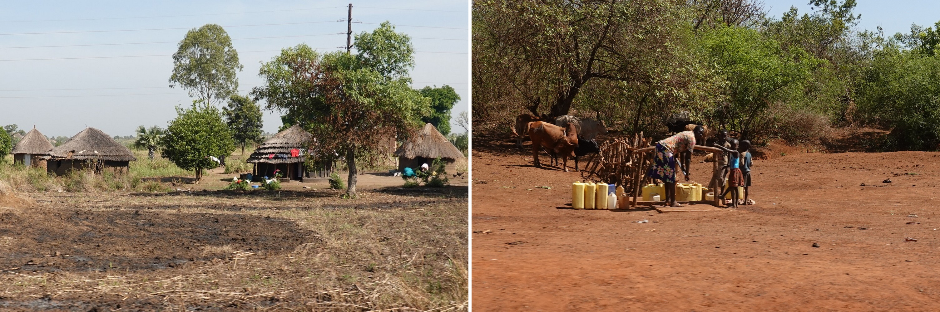
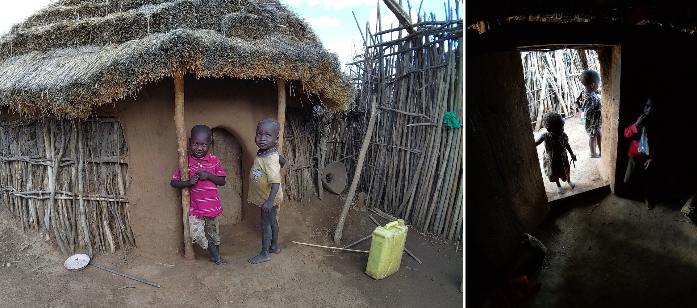
During the drive we passed many traditional homesteads. Typically there’s a large central circular building made of sticks and mud with a thatched roof. This would be the residence of the first wife. Subsequent wives have smaller versions built around the center home. The compound may be surrounded by a thicket fence so cattle can be kept securely. A man’s income is dependent on the wives, for you see, the men generally don’t work. Wives make you rich. Unless you make the mistake of taking a wife in the city where she’ll end up costing you money, I’m told. I was thinking these people may have hit on it, but then I realized the fatal flaw in the arrangement. Marriage.
We stayed in a tent lodge overlooking Kadepo Valley with hills forming the border with Kenya and South Sudan off in the distance. My tent had ensuite facilities, but no phone. On the night stand there was a whistle I could blow in case of emergency…
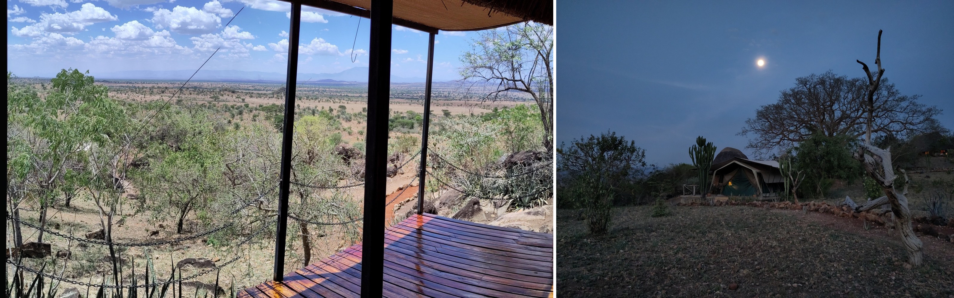
It was hot and dry here. We were at the tail end of the dry season in Karamoja. The animals were suffering from it as the water sources were drying up. We did see many elephants and a huge herd of buffalo, hippos, zebra, giraffe, a group of wombats (collective noun “mob”) with a predator hyena eyeing them, and we also stumbled on a group of eland – very skittish and hard to get close to. No lions. No leopards.


My camera shut down one afternoon. This happens occasionally for some unknown reason, but it usually comes back up with a reboot. But it was out for the count one afternoon. At about the same time Brighton’s phone stopped working. We were in the shade, but supposed that the heat was causing the electronics to shut down. I looked up the specs for my camera that evening, and Sony says the max operable temp range is 40C/104F. It was hot, but I would have thought the camera would have been designed to operate a bit warmer than that…
I thought back to other hot experiences. Traveling in Xinjiang province in western China, John and I were visiting the ruins of Gaochang in the Turfan depression – the low point of Asia. It was 50C/122F. I looked down to read a map, and the lenses to my glasses fell out – the metal rims had expanded in the heat. I think the hottest temp I’ve experienced was in Death Valley in California. The temp was reported as 130F/54C. I came back to the campground one evening after being out all day, and I remarked to the ranger that it had really cooled off. He said, “Yeah. It’s only 105 now.”
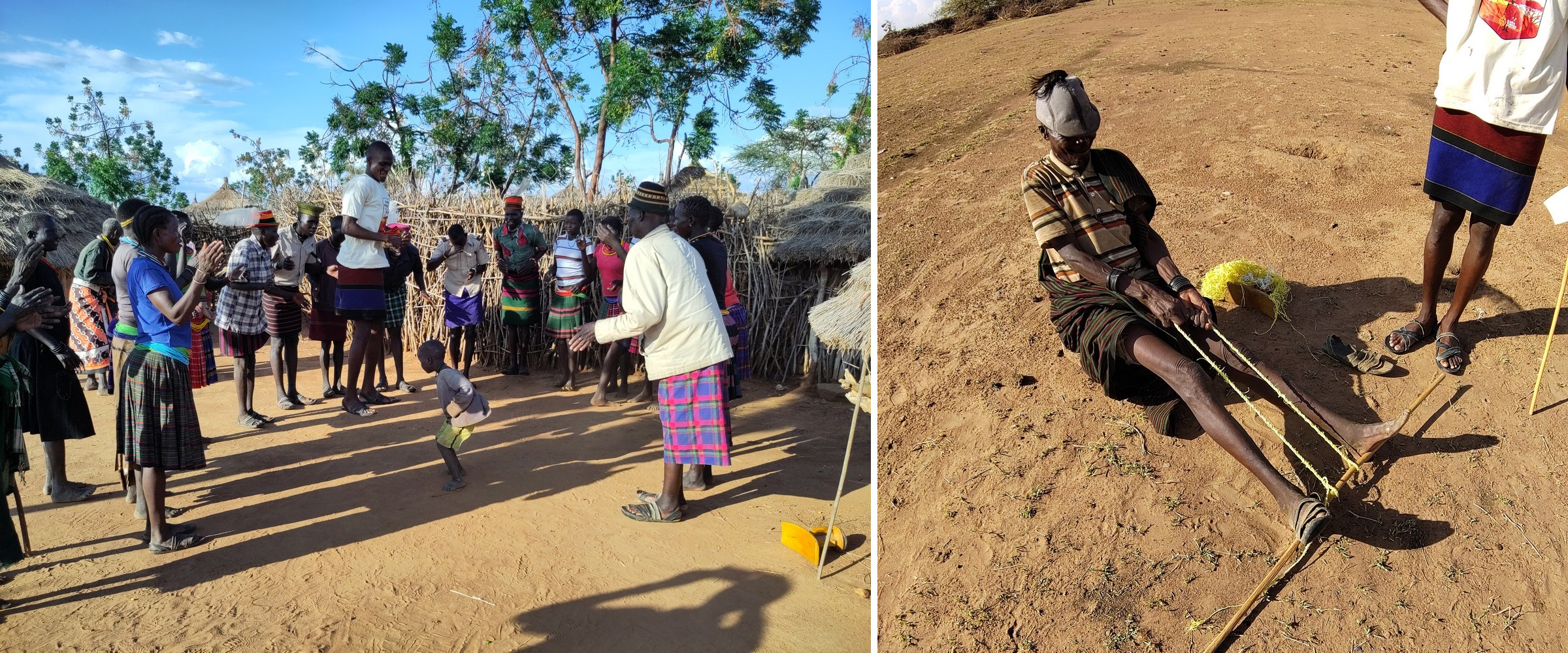
Moroto and the Karamaojong
We split the two day drive to Kampala/Entebbe by spending the night in Moroto and visited a traditional Karamojong village. The whole northeast was very dry. Farming and agriculture look pretty difficult. The region is very flat except for a few mountains and rocky outcroppings that appear. There were signs for every international aid agency you could think of announcing their projects and involvement in the area. So although it might be true that no one in the southwest of Uganda starves, it is not true in the northeast.

The Karamojong people are actually several different tribes and descendants of the same stock of people who left Ethiopia a long time ago and became known as the Masai in Tanzania. Like the Masai, the Karamojong are semi-nomadic cattle herders. Their other main economic activity is cattle rustling. Your wealth is measured directly in how many head of cattle you own (indirectly by how many wives you have), and you need cattle to pay a bride price – typically 100 cows. This activity often involves murder, so it gives people the opportunity to form tight family circles and feuds.
A flood of guns became available when Idi Amin’s army fell into disarray in the late 1970’s. This transformed the traditional form of rustling using spears into a much more deadly pastime. Starting in 2011 the Ugandan government began disarming the locals and crime and violence has declined. Unfortunately, Kenya is just a stone’s throw away and they have not disarmed their tribes, so there is some cross-border rustling and the associated violence that continues. But there is a fairly large Ugandan military presence trying to keep things under wraps.

Our local Karamojong guide told us that a couple of years ago one of the richest men in the area was killed. He had 36 wives and an equally impressive number of cattle. His herd had been the target of rustlers, so he and his son got some military personnel (he was rich, so had influence) to confront the thieves and was killed along with his son and their escort. Hence the recent travel warnings.
This is the process for getting a wife. After the girl gets pregnant (I think I missed a step), the boy in the company of his friends has to slaughter a sheep at the entrance to her family’s compound. The girl’s family somehow accept this as a down payment for their daughter. The girl then builds two separate houses within the family compound, but somewhat isolated from the rest of the household. One house is for her and the other one for the boy and his friends when they come to visit. When the baby arrives, he’s expected to give her parents a few cows and 40 goats. Finally, when he can come up with 100 cows he can claim her as his wife.
But there’s a potential snag. Anyone else who can come up with 100 cows can come and take her at any time, though he also has to take the child under his care. So there’s a bit of an incentive to steal those cows in order to move the process along. In many societies it is seen as advantageous to have sons. You can see that in this culture daughters are preferred so you can trade them for cows. So I guess if there’s an unmarried girl with a female baby, she’s likely to be snapped up.
Jinja and Entebbe
Continuing the drive to Jinja, the region became more and more green. I wondered why the nomadic Karamojong didn’t migrate just a few hours south so they didn’t have to depend on foreign aid to survive.
Jinja is where the Nile river starts, flowing out of Lake Victoria. There used to be rapids here, but a hydroelectric plant was built in the 1950’s which submerged them. The reliable electricity has made Jinja the industrial hub of Uganda.
So you come here to see the source of the Nile. It’s pretty underwhelming, actually. And Entebbe is the suburb of Kampala where the airport is. It was the scene of the Israeli raid to free some hostages hijacked in an Air France flight in the 1970’s. When I was here in 2000 there were plans to convert the remains of the plane into a cafe, but this never happened. It’s still sitting around, having been stripped of everything but it’s outer skin.

Thanks Teacher, another good story and lesson. How great to have an honorable mention in one of your ecards!
BUT. This statement is very bold, even though you have been all over Europe with those delicious pastries. Some of the best food I’ve ever had. Anywhere.
So on the fresh water lakes thing. Here are a couple of my favorite pics.
[image0.jpeg][image1.jpeg]
Security threat. Hummm. I wonder why the âResortâ was empty.
Take care and be safe!
Jim